Leveraging satellite data and machine learning to provide accurate erosion risk assessment for environmental monitoring and sustainable land management.


Fléttan is a predictive algorithm that measures the risk of soil erosion more accurately and integratively than any other existing model for the Arctic region.
This is accomplished by harvesting earth observation data from the Sentinel-2 satellite, calibrating satellite data with localized historical data, and implementing state-of-the-art Machine Learning classification algorithms.
Our solutions are designed to prevent damage, protect landscapes, and build long-term resilience.


The Fléttan project was launched in December 2021 when we won the first place at the Cassini Hackathon, supported by the European Commission’s CASSINI Program. The team, comprising diverse expertise in biology, GIS, entrepreneurship, and programming, stood out among 70 startups and 300 participants from 10 countries. Fléttan’s winning solution focused on using satellite imagery to address soil erosion in Arctic ecosystems. This innovative approach, blending remote sensing with machine learning, won recognition from the Soil Conservation Service of Iceland (Landgræðslan) and marked a notable start for Fléttan’s journey in the “Life on Land” category.
We are excited to announce the expansion of our Fléttan family with the addition of two brilliant minds, Eromanga Adermann and Daniel Fernández, to our working group. Their expertise brings fresh perspectives and innovative ideas to our mission. Eromanga, with her extensive experience in machine learning and data analytics, will be responsible to enhance our algorithm’s accuracy and efficiency. Daniel, a seasoned expert in applied theoretical physics modeling, will contribute significantly to refining our models and expanding our research scope. Together they will form the backbone of our research & publications team, driving our project toward new advancements in Arctic environmental protection.
Exciting news! Fléttan has been awarded the Fræ grant from Rannís, a significant step toward turning our vision into reality. With this grant, Fl’ettan will refine our technology, leveraging remote sensing, machine learning, and environmental expertise to create a solution that helps land managers, policymakers, and communities protect Iceland’s fragile landscapes. Fléttan’s journey started as an idea during a hackathon weekend, winning both the Icelandic and European grand prizes, and has since evolved into a mission supported by specialists and stakeholders who believe in our impact. This funding brings us closer to launching a subscription-based platform that delivers critical insights on land degradation, ensuring sustainable land management for the future. Stay tuned—this is just the beginning!
Our dedicated team at Fléttan is thrilled to announce the completion of a comprehensive soil erosion map for Iceland, now available on Ellipsis Drive. This significant milestone represents a leap in environmental monitoring, utilizing state-of-the-art machine learning algorithms and remote sensing data from the Sentinel-2 satellite. Our map provides crucial insights into soil erosion patterns in Iceland, serving as a valuable tool for environmental conservation and land management efforts.
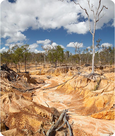
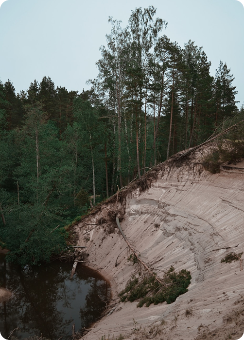
Soil, the foundation of life, is surprisingly more fluid than solid. It shifts, crumbles, and reforms in response to environmental changes. Yet, the World Wildlife Fund (WWF) reveals a startling fact: we’ve lost half the planet’s topsoil in the last 150 years.
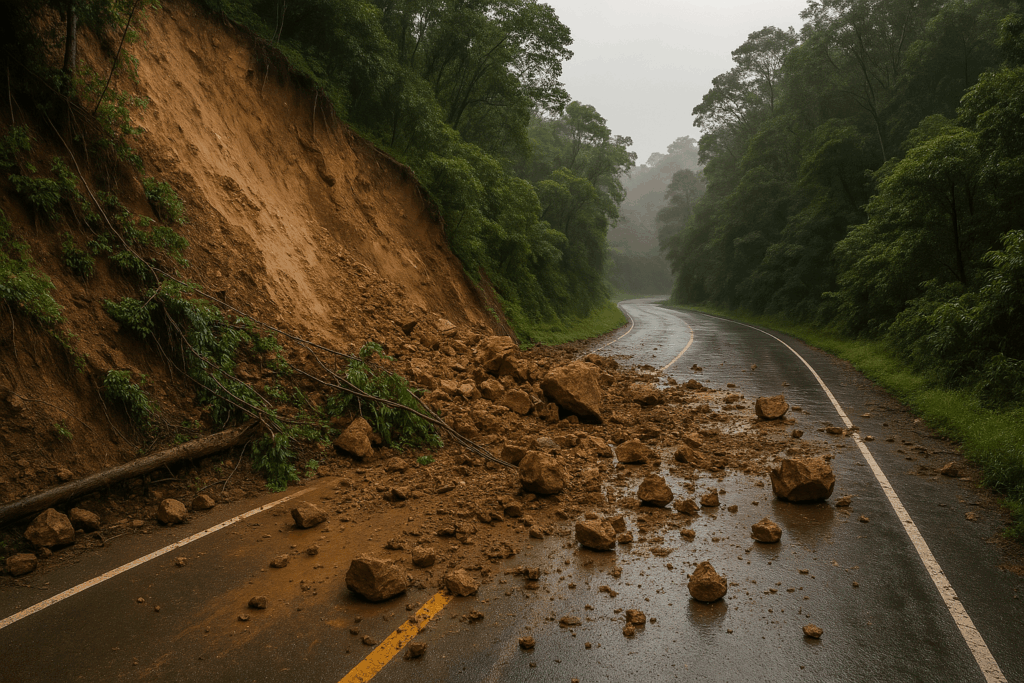
While natural processes do contribute to soil degradation, human actions, especially poor land management, significantly worsen this issue and contribute to climate change. Soil plays a crucial role in the global carbon cycle. For instance, arctic soils alone contain about 1.5 trillion tons of carbon—more than the combined amount in our atmosphere and forests.
This carbon remains trapped in the soil due to permafrost and extensive peatlands, making northern circumpolar soils a major carbon storage. As we face increasing soil erosion, there’s a pressing need for more effective solutions to prevent this carbon from being released into the atmosphere, which would otherwise accelerate climate change. The impact of soil erosion in arctic areas, like Iceland, is particularly critical and cannot be downplayed.
In today’s market, professional project developers across various industries, from construction to soil protection, typically calculate soil erosion using observational qualitative research methods. These methods often rely on costly probes and established models like the Universal Soil Loss Equation (USLE), Revised Universal Soil Loss Equation (RUSLE), and others.
The choice of models usually varies based on the country and its specific environmental conditions, as some models offer greater accuracy for certain climates. However, it’s important to note that these mathematical models are often seen as providing “average” estimates. They may not be highly precise, especially when applied to extensive land areas or specific smaller ecosystems.
As regulations become stricter in areas prone to high soil erosion, our mapping technology will be an essential tool for decision-making. It’s not just about identifying areas at risk, it’s about understanding the specific risk factors involved. This insight is crucial for project managers involved in strategic city planning, coastal reconstruction, and sustainable development initiatives.
Our product goes beyond identifying risk areas, it also pinpoints the optimal locations for new projects. Conversations with industrial engineers have highlighted several key concerns in new project locations, such as soil health, water saturation, and proximity to water bodies. Our map addresses these concerns by providing detailed information, including these factors and more, accessible via a hover-over feature. This makes it an invaluable resource for responsible and efficient project development.
Icelandic experts have traditionally found generic models ineffective for research-based remediation efforts due to the harsh and unpredictable Icelandic climate. As a result, hands-on field sampling has been the primary method used until now.
Our breakthrough is significant: we’ve achieved an 80% accuracy rate with our maps, overcoming challenges that others have not addressed. This achievement gives us a distinct competitive advantage in the Arctic region, where such precision and adaptability are crucial. Our approach revolutionizes how soil erosion and related environmental issues are assessed and managed in these challenging conditions.
Our initial prototype is set for beta-testing by Landgræðslan, where it will undergo a crucial evaluation phase. We’re committed to refining our technology based on the expert feedback we receive from them. The first version of our Graphical User Interface (GUI) is tailored to meet the specific requirements of Landgræðslan’s project GróLindar. However, our vision extends beyond this initial application. We plan to continually gather data and integrate features that will make our product relevant and valuable to a variety of other potential markets. This approach ensures our technology remains versatile and adaptable to diverse needs in the field of soil management and environmental protection.
Iceland’s soil data is the oldest and most thorough data in the entire world since it is the oldest soil erosion department, globally.
Fortunately for Iceland, this data, the ground truth data of the soil erosion risk, is completely free and available upon request from The Soil Conservation Service of Iceland (Landgræðslan), which we will use for estimations for calibration and validation purposes.
In Europe this data is generally freely accessible as well, upon request.
For the Arctic, the data is available, upon submission and approval of an application describing the research project. We are in the process of applying for this data.